Walking across the crater

For our first year anniversary (wedding pictures here) last February we went to Kailua-Kona Hawaii. It was the first time in Hawaii for me. I wanted to wait until their stupid gun laws allowed me to carry but Barb did such an awesome job bargain shopping that travel, lodging (in a nice condo), and meals for the week came in at under $1000 (IIRC) that I decided it was worth sacrificing my principles.

It wasn’t quite what I expected. I expected numerous huge beaches. I expected jungle like forests. I expected flowing lava and blobs of red hot rocks flying through the air. I was wrong.

That doesn’t mean we didn’t see and do some really neat things. We did. The high point for me was walking across a volcanic crater. This crater:

BingEyeView

Continue reading “Walking across the crater”

Visit to an oasis

Growing up in north central Idaho an oasis was something I only saw in cartoons and perhaps on some television show. I have driven across the deserts of central Washington, southeastern Oregon, and Nevada many times but never came across anything similar to an oasis I would recognize from the cartoons of my childhood. They remained somewhat of a mythical place.

That changed last January when Barb and I visited the Palm Springs California area. We visited several oases in the area but by far the most interesting and pleasant were the West Fork Falls and Palm Canyon trails.

Since it has essentially the same trail head as Palm Canyon Trail and is only 0.1 miles long if you go to the Palm Canyon Trail area you must check out the West Fork Falls Trail. Barb and I were wandering around and I noticed something odd. I then began taking a bunch of pictures of the trees. Barb thought I was acting a little more strange than usual with the sudden interest in taking so many pictures of the trees. I had to explain. Check out the pictures below:

20190115_141531


Continue reading “Visit to an oasis”

Naches Peak Loop Trail

Last Sunday, after hiking the Mount Rainier Skyline Trail the day before, we hiked the Naches Peak Loop Trail. It was a much easier hike, and while very pleasant, was no comparison in the Skyline Trail. Any other day it would have been an incredible hike. But after the Skyline Trail experience it was merely great.

For the most part the trails were wide and flat. There were a few narrow and rugged spots but nothing that caused us real concern. The views were wonderful. In places the wildflower were so plentiful the air was filled with their scent even as you walked by.

20190804_103819

20190804_104136

Continue reading “Naches Peak Loop Trail”

Mount Rainier Skyline Trail Loop

Barb and I have visited Mount Rainier several times. There have been others but here are the ones I have blogged about:

Over the weekend we went again. This time Barb reserved a campsite (reservation required and they are booked six months in advance) so we would be closer to the Skyline Trail Loop and could get an early start and find parking. We still had to park about a half mile away from the trail head.

20190803_184229 

She has been wanting to go on this hike for years but it never seemed to work out. We took the upper loop and probably were within 2 miles of Camp Muir.

The weather was stunning. The air was clear, the temperature was pleasant, and there was no wind. The views were stunning.

20190803_134103

Continue reading “Mount Rainier Skyline Trail Loop”

Snowpocalypse

The temperatures weren’t anything like what recently happened back east but Seattle had it’s own extraordinary weather over the last couple of weeks. Here in Bellevue we had snow over 16 inches deep. The weather historians said it was the most snow since the winter of 1968-1969. With all the hills around here there were lots of cars which didn’t make it home and were abandoned on the side of the street. Some of them were badly crumpled.

We were without mail service for about 10 days. No Amazon deliveries for a simlar timeframe. No garbage or recycling pickup for three weeks. Our power stayed on except for a few outages that lasted no more than 30 seconds. Others, within a quarter mile of us, were without power for a couple days.

I worked from home for about six days as no one else on my team could make it in to work. I could have made it with my car. I could even walk to and from work if I really wanted to. But I didn’t see a point to it. Just stay put and don’t risk getting smacked by someone who didn’t have the proper tires on their vehicle.

Barb’s brother had a surgery scheduled for last Friday in downtown Seattle. His wife had little or no experience driving in the snow so Barb and I volunteered to bring them home after another snowfall. He lives on a hill close to the hill Barb and I live on. The street we live on had not been plowed and had several inches of snow on it. With no idea what his street conditions were like I took off the all season tires which would have been adequate for our street and getting into Seattle and replaced them with studded mud and snow tires. We had no problems traversing the snow and made the trip to and from downtown Seattle without any unexpected adventures.

What was odd to Barb and I was the run on groceries. The shelves of bread, milk, meat and fresh produce were almost completely bare. We got a few things before the snow came but not really much more than usual. I did fill the gas cans for the generator and topped off the tank in my car but we would have been just fine without the extra supplies.

The only issue we had was the snow damaged a gutter as it slid off the roof over the deck.

The Seattle Times reported heart warming stories of people helping others. Daughter Jaime, also in Bellevue, spent many hours shoveling snow in her condo parking lot to help clear a path to the street. She also helped numerous people get out of their car ports with cars poorly equipped for the adventure.

Below the break are pictures of the snow around our place. Continue reading “Snowpocalypse”

Whidbey Island plane crash

Today started out fairly typically for me as I went to Whidbey Island for a pistol match at Holmes Harbor Rod & Gun Club. The weather was beautiful and I took a few pictures on the ferry and, as usual, tweeted one of them:

We started shooting on time and things were going fairly well for me considering nearly everyone else was shooting Open class guns and I was shooting Limited.

Then about 11:15 a plane engine could be heard louder than usual and changed tone. Perhaps it went from moderate power to full power?

I wasn’t paying much attention. I was under a shelter and couldn’t see the sky. Others, at the end of the shelter could see in the direction of the sound and looked at the sky. They announced that it went down and very shortly after that we heard the thump as the plane hit the trees in the woods.

The event director, Steve, stopped the match and someone ran off the 200 feet or so to the restaurant to use the land line. The cell service is poor to non-existent depending where you are on the range so that was probably the most reliable means of calling it in. There was another plane in the air and circled the area where the plane went down. We talked about it for a bit. What should we do? What could we do? The woods were very thick. I wasn’t even sure we could make it through the woods from our direction to the plane crash area. Surely the airport, on the other side of the woods, would be the better approach. I told the event director, “I don’t think there is much we can do.” He agreed. And we finished shooting the match.

We just finished, and hadn’t even figured out who won the match when someone in firefighter clothing showed up. He asked us to shut down the range. They couldn’t find the plane from the other direction and wanted to try from our direction. “And can some of you guys help us search?”

We immediately agreed. As we started toward the woods where the plane went down we could smell the fuel. The firefighter told us that if we found the plane we should stay away because of the fuel. We didn’t want to risk starting a fire or getting caught in a fire.

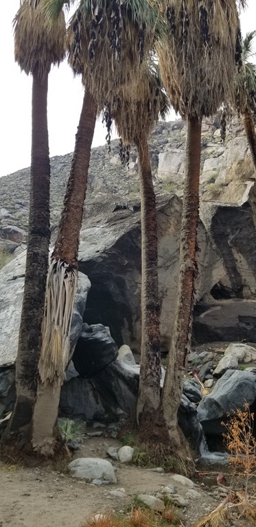
We walked at a brisk pace down the road from the falling plate range past the open pistol bays to the trail that led into the woods. There was an archery target set up about 50 yards from the end of the road at the bottom of a draw with a trail to it. The walking was easy enough to there but the trail then disappeared.

Continuing straight was light brush and easy enough. But my impression from where the other match participants had indicated the plane went down it was off to our right. No use in us all staying in a group and since we didn’t really know where it was at spreading out was probably the best plan even if the going was rather tough. I was wearing thermal underwear, blue jeans, a t-shirt, a sweat-shirt, my Boomershoot M-65 field jacket, gloves, eye and ear protection. I was basically “armored” against the brush. It was just below my chin. I could see over it for moderate distances. Most of the other people in the group were significantly shorter than I and would not have been able to see more than a few feet had they tried to navigate through this brush. I had to push it away and step over small fallen trees and watch for holes and ditches. It was slow going.

It was probably only about 225 yards into the woods when I came out of the thick brush into relatively thin brush within about 100 feet of the plane ahead and to the right of me:

image

The picture below shows more context:

AerialViewAnnotated

I yelled several times to announce that I had found it and kept my distance for a while.

There was no smell of fuel so I approached a little closer. The plane was badly mangled, upside down, and backward from the direction of flight. It had flipped after hitting the trees.

From the time the plane went down to the time I arrived at the site it was just under 30 minutes.

There were no sounds and no movement. I figured the pilot was dead or unconscious. I couldn’t tell if there was more than one person in the plane.

I took a picture and waited for the search and rescue people to arrive and take control of the scene:

20190112_114550

The firefighter was the first to arrive after about two minutes and he radioed to others and informed them there was one person alive and one dead. I then saw the person moving their left arm occasionally. He asked me to use my cell phone call 911 so they could get GPS coordinates to guide other rescue crew to the site. He radioed that there was no way for a helicopter to get in and to send in someone with a chain saw to cut a trail out.

A woman showed up from the west and began helping. I used my knife to cut a few cables holding the left wing to the body of the plane and then she and I moved the wing to get better access to the people in the plane.

More people showed up. Some were from the pistol match and some were wearing emergency clothing and radios:

20190112_115158

We continued moving small trees and debris from the body of the plane and made plans to move the plane to get access to the female passenger.

When the plane was clear of debris we lifted the tail of the plane straight up. The engine of the plane was mostly broken off and the body hinged on the remaining metal that attached to the engine area. We held it directly on it’s nose while the rescue workers cut the seatbelt on both sides and pulled the woman from her seat. She moaned and cried out about her leg. They worked her free of the debris as gently as they could and moved her away from the plane to examine her as we tipped the body of the plane on over and gently set it down. Someone examined the male pilot for 30 seconds or a minute and announced, “There’s nothing.”

A man with a chainsaw arrived from the west and the original firefighter asked us to help the chainsaw guy clear a path. In part, I think he wanted us to leave so he and the other rescue people could examine the female passenger with a little more privacy. There were about 10 or 15 people onsite now and that was more than enough to help clear the path to the road to the west.

I headed back to the range to collect my gear and report to others that I was going to be later than expected for my appointments that afternoon.

As I drove away I came across two people from the match just outside the main entrance. They had walked out to the west and then down the road to the gun club. I drove another couple hundred yards and found a group of three walking down the side of the road. I offered them a ride, which they accepted and I took them back to the range and their cars.

News stories about the crash:

Mount Catherine

Last Sunday Barb and I hiked up Mount Catherine. We were hoping that by driving east of Snoqualmie Pass and getting up near 5000 feet in elevation we could get out of all the forest fire smoke around home. No such luck, but it was a nice hike anyway. We probably will go back sometime when the air is clear and we can see something in the distance other than the haze.

20180819_100647

The drive to the trailhead really requires a high clearance vehicle. Even with my Ford Escape we bottomed out once on some particularly high rocks. The trail is pretty nice. It’s not a walk in the park with a wide smooth path, but it’s not one of those trails which “you have to believe it in order to see it” either (been there, done that, got lost, it wasn’t our favorite outing). The last little bit near the top is steep and it little more than dirt steps in the side of the mountain. No big deal when it’s dry but it could be treacherous when it’s wet.

Continue reading “Mount Catherine”

Idaho visit

Last weekend Barb and I went to Idaho. We delivered more chemicals for Boomershoot 2019, trimmed some trees along the road to Boomershoot Taj Mahal, and attended my high school reunion. The weather was a little on the warm side but not bad. We took a few pictures during the trip:

20180803_124351

I believe this was west of Colfax on Highway 26. We found the clouds quite pretty.

20180804_104422

This is the lentil field just south of Boomershoot Mecca.

20180804_113014

I”m planning to repair these steel targets at the tree line before Boomershoot 2019.

20180804_113229Adjusted

I was trying to do the equivalent of this one from almost exactly 10 years ago:

IMG_1714Web

20180804_113359

Another view of the hay bales with the shooting line in the background.

20180804_130111

For many years Barb had digestive issues with wheat. Those issues mysteriously went away a few months ago (Barb is skeptical of my suggestion it was Dr. Joe’s cure for everything, and I’m skeptical of her hypothesis of a spiritual/energy something or other healing). Here we have her next to a field of Huffman Wheat.

Crater Lake

Last Saturday and Sunday Barb and I hiked various trails around Crater Lake. I’d been there a couple times before but hadn’t really done any hiking.

Our first hike was to The Watchman Lookout:

IMG_9737

At over 7000 feet above sea level there was some snow but nothing blocking the trails:

20180630_112056

The weather was wonderful with visibility probably exceeding 100 miles.

20180630_124601

With such clear skies the water was intensely blue (this is straight from my phone camera, no color adjustments):

20180630_105105

20180630_110413

The incredible blue color is not new. 1853 prospectors named it “Deep Blue Lake” and in 1862 another set of prospectors named it Blue Lake. The color is because the water is extremely clear and deep. In the deepest part it is 1,943 feet deep. It is so clear that person in a submersible vehicle at the greatest depth was able to see the flag on the vehicle with only the sunlight which made it to those depths.

The island is called Wizard Island. The crater on the top of the island is called Witch’s Caldron. If you take a boat to the Island you can explore the entire island. We decided not to invest the time (the better part of a day) to go on that excursion.

IMG_9748Adjusted

From the other side of the lake we saw the island named Phantom Ship, a bald eagle, and some very tiny flowers:

IMG_9820

IMG_9800Cropped

IMG_9813

There were several other geological features to be seen in the park which we visited on Sunday but the highlights as seen above can easily be viewed in a single day without strenuous hiking.